Sun 30 Aug 2015
Richard and I had booked a week in Ullapool – partly because we like the place but mainly because I had six Munro Tops to finish off in the area. After having superb weather on the Saturday when we stopped on the way up for a day in the Cairngorms, Sunday dawned (or rather didn’t) dull, very windy and excessively wet. As the week’s forecast was pretty dire, however, I thought I’d best make a start and chose my easiest (navigationally) hill and also the safest/widest. This was the western outlier of An Teallach – Sgurr Creag an Eich – which, if the weather cleared up, would be a great hill to couple with the Corbett of Sail Mhor.
My route started off up the Ardessie Gorge – I’d chosen this route partly because I really wanted to see the gorge in its entirety. Little did I know how spectacular it would become by the end of the day!
(click on photos for full size/resolution)
Richard came with me to the starting point as the start of the walk isn’t too far from the Dundonnel Hotel and the lovely saltflats and bay at the head of the sea-loch of Little Loch Broom. In the other direction is the pretty Badcaul and, a couple of miles further, the gorgeous Gruinard Bay. I left him with the car keys and told him I’d be between five and six hours – little did he know, he was due to be trapped in the car for the whole six hours with nothing but a puzzle book, flask, rain battering on the roof and the car being pushed around by the gale! Unfortunately, he can’t drive so was stuck where he was for the duration (I do keep telling him to learn).
I put full waterproofs on and fastened everything up to the neck and walked the 100 yards or so down the road back to the Ardessie Gorge’s final waterfall. It was quite impressive and I took a photo – I was glad I had as when I returned it made a great comparison to my return photos!

Just over the road bridge across the river, there was a small cairn and a wet track started off up the hillside on the true right bank of the burn. The gorge was indeed impressive… lovely sandstone slabs forming huge steps up the hillside with pretty waterfalls coming over them in various scenic configurations. The path was pretty wet already though and so I had to watch my footing until it became a bit drier further up the slope. There were some wet slabs to clamber up in places but the path splits into many parts so you can probably avoid them if you want – just on very boggy ground.

I took a few photos on the way up the gorge – further up, the gorge became extremely deep and there were some spectacular large falls when I peered over the huge drop.

After this, however, the gorge became less spectacular and also less visible so I got on with plodding over the lip into the long corrie/hanging valley of Coire Mor an Teallach. I expected the path to end here but, luckily, it continued on for quite a way and was pretty good going.
Eventually the path started to peter out as the ground became tussocky and boggy. I still managed to find small areas of what looked to just be deer paths – certainly the main users were the deer anyway. Very few bootprints were to be seen – just the occasional walking pole hole and the odd section where a boot had slipped. I had to pretty much watch my footing from there on until I turned the corner of the corrie.
Sgurr Ruadh, the craggy end of my long ridge had appeared looking imposing – although I know of people who have tackled the ridge-end, I had no intention of doing so as the map said there were easy grass slopes either up the side of the next part of the ridge or a small northern-eastern spur which also looked easy. I tried to take a photo of the craggy end as it loomed out of the murk ahead but found I’d run out of film. As it was raining pretty heavily and there was nothing solid to sit on, I decided it wasn’t worth changing the film at this point and just continued plodding on. The gale would have been blasting the rain straight into my lens anyway and the light was terrible…
Fortunately, after turning the corner of the corrie and rising up over a hump, the ground became much more rocky and quite a bit drier. It was certainly easier to walk on and I managed to study the ridge and make much better progress. The two Munro summits of An Teallach appeared ahead for about twenty seconds – a good job I was looking at that time – the wall of the main peak looked a long way away though and I knew my summit was only just short of Sgurr Fiona.
I soon came to where I needed to cross a major burn – at this point it had re-routed itself over grass and was just flowing overland. I found a stony section which was quite shallow and just ran across with my boots in the water – it didn’t reach the top of my boots but, after the long sloshy walk in, my feet were thinking about getting wet by now anyway.
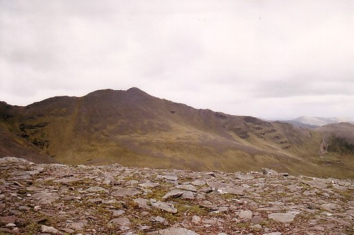
The stonier ground continued to the second burn which was much narrower and very easily crossed at the point where it met the foot of my northern spur. I hopped across and started up very rough and holey ground to start the rocky spur. I had a choice of long, wet grass, or outcroppy and rocky going – I chose the latter to try to keep my feet drier for longer. I was a little perturbed at this point to see a large pinnacle ahead on the start of my route along the ridge, followed by what looked like a couple of narrow, rocky sections. As the wind was fairly blasting across that section, I hoped all was okay when I got there…

The spur runs across the middle of the photo (taken on another trip)
The spur was pretty short and had no difficulties and it was nice to be sheltered from the wind and horizontal rain for twenty minutes or so as I ascended. I was amazed to see that the ptarmigan, which were peering at me from rocks above during my ascent, were around three-quarters white. As they only turn white in winter, that shows what a terrible summer we’ve been having this year – I bet they never completely turned to brown this year!
Near the top of the spur (which had its own lovely summit but unfortunately I didn’t visit) I managed to contour across easy ground towards where the rock tower was. I could see the ridge was perfectly wide and easy and that the rocky sections were just along the edge over the corrie and very easily avoided. They would make useful reference points for my return down the ridge though. I took an altimeter reading at this point so that I could recognise my spur when I came back down in case the cloud descended further. I was later very thankful I had!
Unfortunately, while I’m sure the ridge is a delight on a nice day, with superb views to An Teallach to the left and the lovely Strath na Sealga and the spectacular Beinn Deargs on the right, in this weather it was a demoralising trudge with nothing to see except the various rock formations.
As I plodded upwards in the driving rain and blasting wind, I realised the water had got through my old and battered jacket sleeves and that my arms were wet and becoming very cold. I considering putting my gloves on but they would have been hard to pull onto my soaking wet hands – the water was running off my jacket drainpipe-fashion onto my hands and camera case and both were sodden. Luckily the camera case is pretty waterproof and also, with my camera being 100% non-electronic, it doesn’t really matter if it drowns!
I decided I’d just have to clench and unclench my fist on the windward hand to keep it from freezing and continued on upwards. There was false summit after false summit. Interesting looking rocky tors and formations appeared out of the thick mist but, as I reached them, there was always another looming dark bulk appearing mistily out of the murk above them.
Sgurr Creag an Eich’s Very Long Ascent Ridge (photo taken another day)
Each successive rise was steeper and longer than the last and I started to become pretty exhausted. I think my exhaustion was partly that I was getting so cold (it was too wet to take my coat off and put my fleece on and there was no shelter on the ridge), partly due to heading slightly into the gale, and mainly because I’d become totally demotivated. I just really wanted to turn round and head back down. Of course, as usual, the only thing stopping me at this point was the effort and suffering to that point – it would all be for nothing if I turned back before the summit!
As I’d started off up the ridge, I’d thought I should really have got my compass out and taken a bearing up it. It’s easy enough to follow a rising ridge as you can always see the next highest section looming out of the mist – it’s not at all easy to come back down it again though as everything is downhill then – the sides of the ridge, which you don’t want, and the ridgeline. It was just too cold, wet, windy and miserable to stop for anything though.
I was even starting to feel peckish by this point but there was no way I was stopping for either food or a hot drink – not on the wet and wind-blasted ridge.
Finally, after a very steep and strenuous rocky rise, I saw there was a void ahead and a path turned left along the edge of it running slightly uphill. Must be near the summit this time surely? Indeed I was – but what a narrow and rocky summit it was. The gale was blasting me towards a drop into a large void to my left forcing me to stay lower than the ridge on slippery boulders over a slightly less steep void. I clung onto boulders above me and placed my feet as carefully as I could as I tried to reach the awkwardly placed cairn along the ridgeline. I hoped none of the boulders would go off down the hill with me on them and that I wouldn’t slip!
After a struggle against the gale, I managed to clamber to where I could briefly tap the cairn and turned immediately to make a very quick exit before I was blasted over the edge to my doom…
I turned back down the ridge from roughly where I’d joined it and just had to keep looking either for the void over the northern edge of the ridge, or looking back up to see if I could recognise the various rocky features I’d seen on the way up. Luckily I have a good memory and had been very observant – I only went wrong once and found I was heading towards the northern void.
The cloud had become much thicker and, with the ridge being consistently rocky and quite wide, I could literally have been heading anywhere – I should have definitely taken that bearing at the start. I hoped I didn’t take a wrong turn and head off down into Strath na Sealga at the back of the hill. Fear of doing such a thing made me stay pretty close to the defined northern edge of the ridge. I continued to recognise rock features though and, eventually, saw the rocky pinnacle at the start of my ridge ascent. I checked my altimeter – yep – 770 ‘metres’ – correct.
Feeling very relieved, I zoomed across the rocky col to the start of my ridge descent. The descent was very slippery and had to be taken carefully but I was pleased to be getting out of there at last. I was soon back at the river crossings.
I pretty much followed my outward route and crossed the two rivers in the same places but was surprised how much had changed since an hour or so before. The dry and rocky sections I’d walked up the corrie on were now underwater and each step was a paddle. I knew the section around the corner was going to be terrible – it had been wet and slippery enough on the way out – now it would be much worse.
The cloud by now had descended into the corrie and, apart from knowing where the river was, I could have been heading anywhere…
After turning the corner for the second half of the corrie, I started to meet side burns to cross – it wasn’t possible any longer to cross dryshod as all the rocks were now under raging water. My feet were already soaked though so I just clung to rocks in the water and splashed across with the water pouring into the tops of my boots. Getting out of here had now become a priority!
Eventually, I reached the corrie lip for the steep descent by the side of the Ardessie Gorge. By now there was a huge amount of spray coming out of the gorge and I knew it was just the pressure of water falling and not the wind as that was blowing down the hill…
I didn’t stop for anything until I was most of the way down the gorge. I then turned for a look at the waterfalls – they had at least twice as much water in as on the way up and were absolutely raging. I decided that it was a great time to change my film and get ‘before and after’ shots – unfortunately, my only photos of the day…


The large slabs I’d previously stood on at the side of the river to get my outward photos were by now under a large and tumultous volume of water. In addition, all the paths I’d used in ascent were now rivers themselves and had waterfalls of their own pouring over the slabby sections. It was a little like gorge scrambling completing the rest of the descent and having to lower down slabs through the waterfalls.
Putting the first photo in again for comparison…
before (above) after (below)

At last I reached the road with a sigh of relief and sploshed soggily back up it to the car. On reaching it and the marooned, bored but sympathetic Richard, I peeled off the wettest of my clothing and he lent me a t-shirt and his sit-mat for the car seat. We hurried back to our accommodation at Ullapool where I completely stripped off to find that, despite waterproofs, the only dry garment I was wearing was my bra. My knickers were absolutely soaked and, on turning my boots upside down, a mini-river of muddy water flowed out of them for a few minutes. They continued to drip for a further day…
I knew it would be a simple matter to dry my clothes out by morning but my boots were going to take days. Fortunately, as they are ‘vegetarian’ simulated-leather boots, you can actually place them on radiators to dry them without them coming to much harm. I was pretty fed-up with how the day had turned out – the weather forecast had simply said gales and showers – showers my foot! The next day was forecast to be the same so I stayed in bed until around ten. I was even more fed up when I got up to find it was a lovely day – it didn’t rain all day and ended up completely wasted as it was too late to go for any of my other hills which were all quite a drive away and long walks. It was the only good day of the week too…
I was made to regret my lie-in even further on the Tuesday when I set off and drove all the way to the end of the Benmore Lodge track to do Ben More Assynt’s south top and found the weather was exactly like my hill day had been. Constant rain all day, cloud even lower – essentially down to the road – and a fairly lusty north wind. I mused briefly at the start point but Richard soon persuaded me it would be pretty silly to continue – all those miles on my car for no reason 😦 We just ended up slobbing around Lochinver where there isn’t much to start with and most things were shut!
Remind me – why do I do this again??
Stats: 11 miles, 3285 feet of ascent (approx), 6 long, wet hours

[…] Dreich on Sgurr Creag an Eich. […]
LikeLike
Looks a typical summer’s day 😉 I can vaguely remember what a good summer is like, congratulations on your perseverance 🙂
Those river’s rise at a scary & dangerous rate!
LikeLike
That river could have been nasty if I’d been on a longer walk I think! Typical for this year’s summer unfortunately, yeah.
LikeLike
Good grief, rather you than me! A bit of an epic!
LikeLike
I was wishing it was someone other than me up there that day!
LikeLike
Great ‘before and after’ pics of the waterfall – a very graphic example of the problems and dangers of Scottish streams in spate. You showed commendable fortitude Carol!
LikeLike
It’s amazing how quickly they rise – I’ve had friends who’ve been trapped by them and had to go all the way around a whole valleyhead to get back to base!
LikeLike
Yuk! I quite fancy a horseshoe of that side of An Teallach, but I think I’ll be waiting for a nice day! The Ardessie burn is impressive though. I thought you might be interested in these photos of it from last year’s rubbish August (not taken by me, I should add):

(photos Helen Meek)
LikeLike
I remember you saying you did. I’d really been looking forward to that walk and I suppose, in that case, I should have left it for a better day. But we didn’t really have any good days that week (except the next day which the weather forecast conned me into missing 😐 ) so I wouldn’t have got anything done if I’d waited for the weather! I’d also been really hoping to add in Sail Mhor anyway and gain an extra Corbett. I think it would be a nice walk on a nice day so sorry to put you off a bit…
LikeLike
Just looked at those 2 photos in large-size – bloody hell! that was much worse than my day. Is that second one the road under all that? (I’m going by the railings in the photo – looks like the road bridge railings)
LikeLike
I think it is the road – caption on that blog states “Ardessie Burn on 11 August 2014 – pictures © Helen Meek”. I believe it was the tail end of Hurricane Bertha. I remember last August being really bad, but we missed the worst of it in the east. I have vague memories of the main Ullapool road being closed at Leckmelm due to serious flooding. Must’ve been around the same time as those photos.
LikeLike
The more I look at that photo of the water coming down where the path should be onto the road, the more I shudder. I’m now thanking God I did it this August!! 😮
Many thanks for adding those 2 photos – extremely interesting!
LikeLike
Wow, amazing photos! It’s a shame when the weather is terrible and you’ve set aside time to do Munro bagging, but you’d never get photos like that in the sunshine.
LikeLike
You’re absolutely right that our bad weather does make for some spectacular photos!
LikeLike
I’m always amazed at your enthusiasm and dedication to the task Carol. Mine lasted the first five years of munro bagging then started to disappear along with the hill views. That why I like the Lake District so much as there is bags to do and see down there even in poor weather. Highland villages, bar a few rare exceptions, are grim, soulless places in the rain with zero entertainment.
God bless the English and Americans for enjoying the Highlands so much since Queen Victoria put it on the tourist map.
Most Scots can’t stand the place :o)
LikeLike
I just literally choked laughing at that last bit – I can imagine you’re right. To be honest, that was the walk where I started to decide my visits to the West Highlands are numbered. I’m just getting sick of the difficult walking and horrendous weather this year! Richard agrees and just wants to visit Skye in future. I’m dying to get back to the Hebs but can’t see me seeing much of the mainland bits in the West in future. I’ll still go to my favourite ‘Cairnies’ (Cairngorms) though, especially in winter 🙂
Believe me, there was absolutely no enthusiasm on this walk. I hated the whole thing and only found the waterfalls and the gorge interesting. But I can’t give up now so near to the end…
LikeLike
Amazing you saw that much of an increase in run-off so late in the year! Is that normal in your mountains? Maybe it is because of your poor summer. Thoroughly enjoy the accounts of your mountain exploits. Your pictures on film are fantastic. Take care. Bob
LikeLike
I think the extremely poor summer had a hand in it – the ground is saturated, that’s for sure. But I was amazed how much that burn came up and was glad I hadn’t had to cross any really big burns on the way back or I’d have been trapped. The small ones I had to cross really were raging on the way back and the levels had really risen – luckily, they mostly had good boulders in them to cling to as I crossed.
LikeLike
That’s what I was thinking. It was a good thing you didn’t cross anything that couldn’t be crossed on the way back. I always think the same of frozen ground and snow. When it warms sometimes it becomes, what in the morning was easy, an impossible slog.
LikeLike
Well I would have crossed any size of burn on the way out as I had no idea rivers could come up so quickly before I saw that. That rise was only in 2 or 3 hours! 😮
LikeLike
That looks dramatic for sure.
LikeLike
The gorge, and the change in it, certainly was!
LikeLike