Tue 14 Mar 2017
Richard and I were staying at our favourite hotel in Kendal again and, after he’d walked with me on the Monday, he couldn’t face another day ploutering around Outlying Wainwrights so he went off to Windermere on the train and I went and did this round. Like the t’other Wasdale Round next to it which I did last time, I enjoyed the remoteness of this one too… not sure about Wainwright’s route though!
All photos my digi-camera – not the kind of scenery for my proper camera!
After a short eight miles or so drive up the A6 from Kendal, I neared Huck’s Bridge which is where this walk officially starts. However, as I’d been following a slow breakdown truck, I decided to turn off onto the old road – a tiny road just wide enough for the car and with no passing places. Didn’t help that the verges were really soft either after all the rain we’ve had but I was lucky to only meet one vehicle which was a 4×4 and which decided it could manage a small section off road.
I followed the road for the couple of miles to its end at Hause Foot Farmhouse. Wainwright has this as deserted but there are now folks living in it – not only that, but they not only don’t want you to park near them, but they reckon they won’t even let you turn your car round there either! That’s quite ridiculous as there is nowhere else much to turn but, having the small Polo, I decided to back it up onto a small uphill area of muddy grass just before the old bridge and park there – that way, I could just run off downhill without getting stuck and it had got me turned round as well.
I felt a bit bad probably blocking the only other place people could turn round but, to be honest, if the grass section wasn’t available for turning, I’d certainly have turned in front of their property – while I’m perfectly capable of backing for 2 miles, I don’t really see why my car should go all that way in one gear!
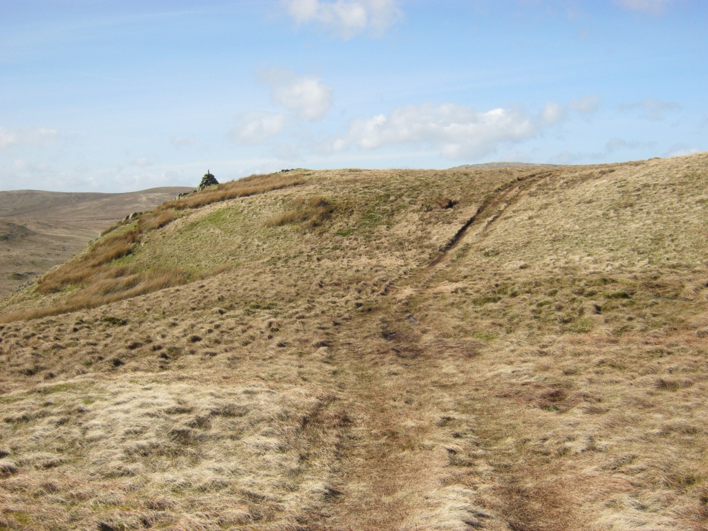
I set off more or less straight up the hillside above the car, just rounding the corner of the beck first. This first hill is High House Bank (1627 feet) and the map said it had several potential wall crossings. I was following one wall and kept looking to see if there were any crossing points. It wasn’t a high wall and I thought I could probably pop over it anywhere but wanted to get out of sight of the house first.
By the time I was out of sight, a fence had appeared atop the wall so I looked for a bow in the wall where I could slip down between the wall and fence. I soon found one and hopped over and under the wire. After that, I didn’t have to cross any more walls but I lost the quad bike track I’d been following and took to pathless and tufty moorland instead.
The ascent had a couple of false summits and was quite hard going across the tufty ground and against the very strong wind. I soon reached the summit however where an onward path appeared.
It was too windy even to put my coat on so I just hurried on down the hill – it’s quite a long way to the col but nice views of the ridge ahead and the Borrowdale Valley to the left. I soon reached a gate and stopped out of the wind to stow my map away as the upland way is obvious – you only really need the map for the valleys here. I used the gate as a handy foreground for the photo of the next hill, Robin Hood (1613 feet) – it looked better than the bog beyond it!

The path disappeared into the bog here for a while but I could see a gate below Robin Hood and headed straight for that. I tried walking on higher ground than the bogs but the tufty grass was much worse going so went back down to the wet stuff.

Looking back to High House Bank from the foot of Robin Hood
There was a short, sharp ascent past some tiny craggy areas but it was hardly any effort to the summit – I’d seen some rocks which looked like a cairn on the ascent but didn’t believe it could be such an easy summit – it was.

Looking back to High House Bank from the ascent
There is a little side cairn before you turn for the summit which I detoured into the strong wind for briefly…
My camera decided it wanted new batteries here so I huddled as out of the wind as I could get to change them and then dashed down into the relative shelter of the onward quad bike track. At least it was a lovely sunny day and nice and warm out of the wind.
It’s about a mile to the final hill of Lord’s Seat (1719 feet) and the cart track rises in sections. There are lovely views back along the route with the Borrowdale valley on the right and my return valley Crookdale on the left.


A couple of zoomed shots for a closer look at the landslips above my return river in Crookdale

I’d reached my furthest summit in less than an hour and a half and had a good look around in all directions before leaving. I could see the ruined sheepfold of Crookdale Fold which Wainwright mentions and there were lovely views to Great Yarlside from my previous walk in these wilds. I took a long shot back along my route having to find some rushes to use as a foreground…

I wavered between heading straight down to Crookdale – perhaps even to the ruined sheepfold – or following the good outward path back to the gate at the foot of the second hill. I suspected the going would be bad in the valley but it did look quite an interesting beck. I decided to set off back partway along the path at least to the col between Lord’s Seat and Robin Hood.

Great Yarlside
On reaching the col between the two hills, I decided it was criminal to not explore Crookdale properly and set off across the rough and tussocky ground towards it. Luckily it was a very gentle descent indeed and virtually no height loss – the going was ankle-breaking stuff though and I soon hurt my ankle on my good leg.
As I’d had a few problems with my bad leg on the day before’s walk, I’d taken the precaution of carrying a walking pole for this walk. I decided it was time to get it out – although it was pretty difficult to use on tussocky ground as you had to look for the best place for the pole as well as where you were putting both feet!
I eventually reached the beck where I could see the going was going to be far worse than I’d imagined. It was pretty terrible. There were sections where you had to climb up above a landslip, sections which were just a few reeds over holes full of water, huge tussocks awkwardly close together and no paths whatsoever. Sometimes, right along the bank (where I prefer to stay as the ground is usually smoother), there would be a short sheep track, but nothing much. I dreaded my bad leg from the day before coming back but somehow my hip coped – just!
In the end, I managed to cross the river – it was no better but the finish at the farm was better that side and river was surprisingly deep and lusty for crossing more than once. The only crossing place I could find which wasn’t mossed over rocks, was a shallow section which I could run across in my boots.
I decided it was easier to cross the foot of the landslips than keep going up and down. There were some fearfully slippery rocks by the river though and the bank was still collapsing so I had to use the pole on the downhill side and have a hand ready on the uphill one.

A ‘good section’ just before crossing the river with the typical going across it and my first hill in the distance still to circumvent…
There were a couple of fencelines to cross but these were pretty low and easy. At last I could see lorries on the A6 rumbling across my view not too far away. I soon reached a new plantation and climbed out to join a very wet track back to the farm. The track was mostly underwater so not a lot of help but it encouraged me on.
At last I reached the car where I had a quick coffee. I checked my watch and found the whole walk had just been two hours 40 minutes. Not bad as the walk is around 6.5 miles and the going atrocious on the return.
A suggestion for others doing this walk is probably to park where Wainwright suggests – on the A6 at Huck’s Bridge – and pass the farmhouse to join the back road. From there I would suggest walking to Hause Foot farmhouse at the roadend and doing my outward route. On the return, after descending Robin Hood and crossing the bog to the gate at the foot of High House Bank, a track goes down right into Borrowdale. This apparently goes back to the old road, although I couldn’t see it starting anywhere from it!

Looks great! Good thinking on bringing spare camera batteries too – I always forget that when I go walking!
LikeLike
I don’t normally need them as I usually take my film camera and that doesn’t need a power source of any kind 🙂
Carol.
LikeLike
I think the Outlying Fells are definitely a group of hills too far for me. The terrain sounds awful and the parking situation similar!
LikeLike
The terrain was pretty bad on that one – the t’other Wasdale Round was better walking until Wasdale Pike and then it was just as bad. But I’m loving the Lake District Perimeter solitude 🙂
Also, you’re really supposed to park on the main road by the bridge there (which I think is the actual ‘Huck’s Bridge’) and that parking looks okay.
LikeLike
Not a set of hills that inspire me greatly going by the photos but a good effort. With so many great Lake District peaks still to climb I can’t see me getting around to this group. I was offline for a couple of weeks but good to be back. Certainly a walk to avoid the usual tourist crowds I’d imagine in a lesser known area.
LikeLike
I’d imagine it’s quite like a lot of the Scottish Borders hills I see on the way up through Dumfries & Galloway though… It’s great if you want to find Scottish-type solitude in the Lakes 🙂 But, if I was coming down from Scotland, I’d be like you and go for the more interesting/exciting stuff in the Lakes.
LikeLike
Very nice looking rolling hills. You made great time on what sounds like some ankle busting terrain. I am glad to hear you can back up a vehicle if you have to. My father used to say, in the mountains you better know how to drive backing up as good as going forward. I hope you are having a good weekend. Bob
LikeLike
I was quite surprised at my time. I’ve had to back my vehicle a couple of miles before down those kind of roads when there was nowhere to turn at the end!
LikeLike
Did you use your mirrors?
LikeLike
for long-distance reverses, yes
LikeLike
My new truck has a back up camera. I still don’t use it.
LikeLike
The only time anyone ever reversed into my car was someone using one of those!
LikeLike
Bleak and moody – my kind of landscape….. 😀 Mind you, walking on tussocks is awful! 😀
LikeLike
Not sure you’d find anywhere much to camp though as everywhere except the quad bike track is either tussock or very wet bog. I enjoyed my day though 🙂
LikeLike
A bleached landscape in dire need of some warming sun. Still, definitely worth a visit. Interesting you mention the other Wasdale. I was driving back from Lismore yesterday on the M6 and I glanced to my right trying to recall the details of when I cycled through that valley in the 70s. Back then it was under threat of being flooded under a reservoir scheme. It was late on a winters afternoon and we thought it would our last chance. Thankfully the plans never came to fruition. Nice piece.
LikeLike
Didn’t know anything about that reservoir scheme – I’m glad they didn’t in the end. It suits being deserted around there – it’s nice to have somewhere that quiet to walk so near to the Lakes. I’m enjoying finding the solitude-bits of England after all my Scottish walking.
LikeLike