Wed 24 February 2021
As I had to spend a whole day away from my house while some disruptive work was being done I decided to hunt the only area with a survivable weather window to walk for several hours in – our area was going to be deluged with heavy rain and all my nearby mountains were too. It looked to have a small area of light rain all day around Langwathby so (lockdown notwithstanding) I set off over there. Before people get too upset, I really don’t think I had any other choice and it’s only around a 25 mile drive anyway and I drive 20 miles each way to work many days each week.
Nearly all photos:
my digi-camera – wasn’t worth taking the proper camera in the awful weather!
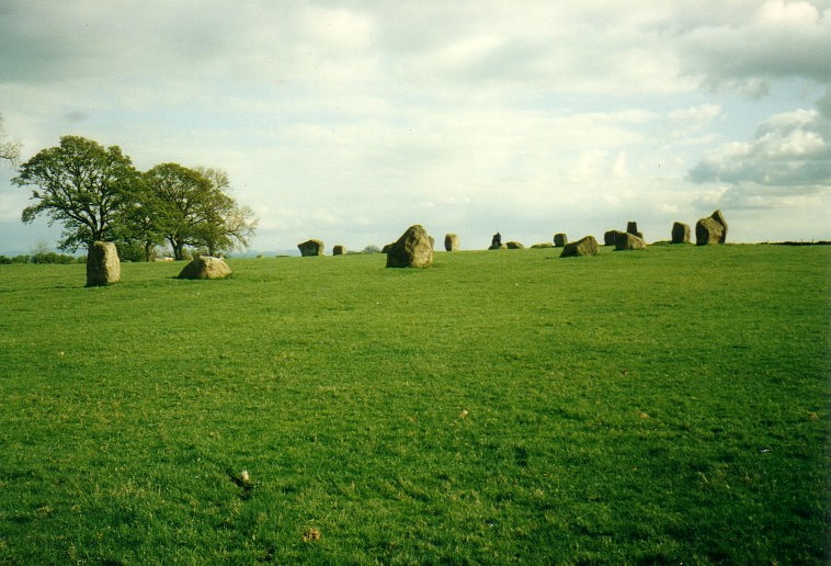
As it was going to be awful weather, I didn’t take my ‘proper’ film camera but just slipped my digi-camera into my pocket – I have to say I was glad I did and it made a decent job of the photos despite the awful weather (it’s normally terrible for landscape photography). I decided that, as there would probably be no visitors in such miserable weather, I’d park at the stone circle in the parking there rather than in one of the villages – I left the little Polo looking sad and isolated and wandered off with my map (which should have been in a map case bearing in the mind the constant wet conditions).
I took a couple of photos here as I left and am also including photos from a much earlier visit on a nice day from my film camera…

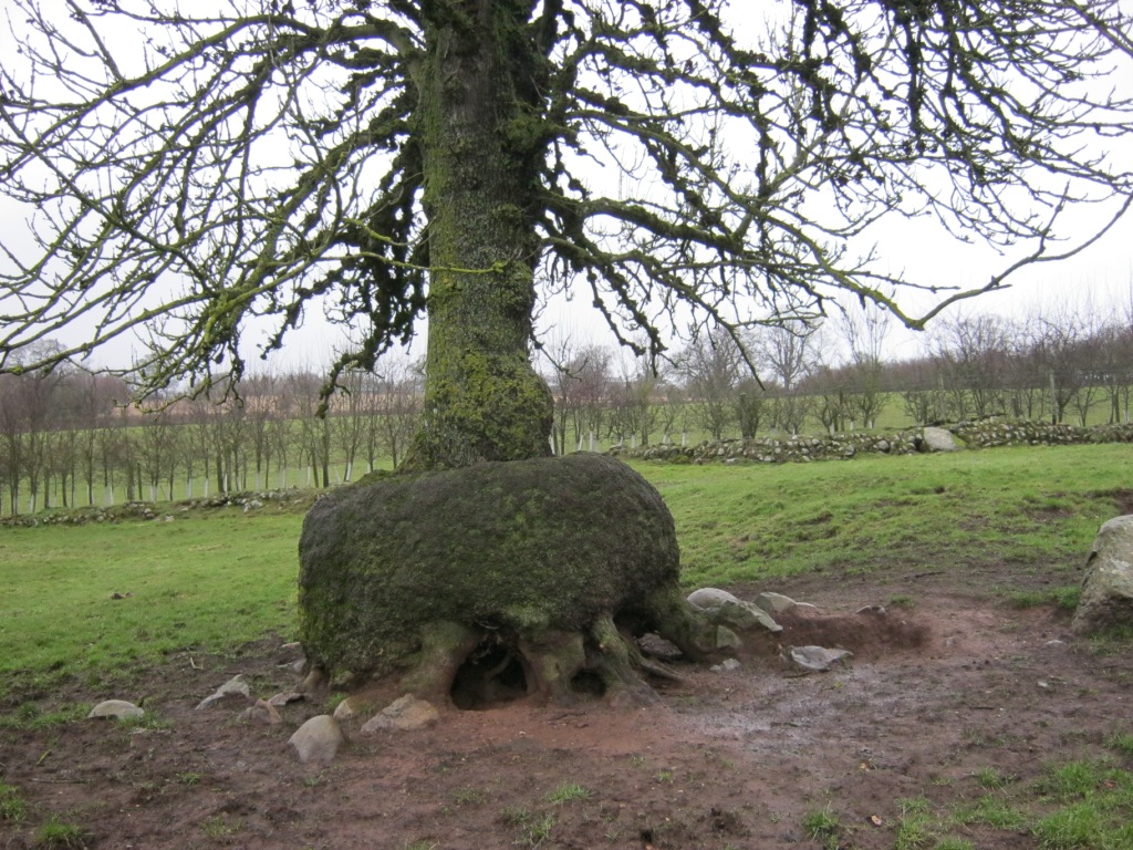
Some of the trees here are equipped with their own bench seat!

I’d noticed on the map that there was, in addition to the main, spectacular circle of Long Meg, also a ‘Little Meg’ a few fields away – I took the path which went that way to hunt it down. When I spotted it, I was really delighted with it – it was a little gem! 🙂

Little Meg Stone Circle

stone detail within the circle

I then left the very muddy fields for a series of very nice fenced-off footpaths which bypassed the village of Glassonby, passed through the churchyard and then set off for another mile or so to the road. Nearing the road the path became very wet indeed but I’d put on my special wet-weather boots which I’d bought from an Army & Navy store back when there were still such things – these were ‘fur’-lined pure ‘wellies’ at the bottom with a goretex gaiter attached as a top – superb boots for mud, snow and wet. The treads are excellent too…
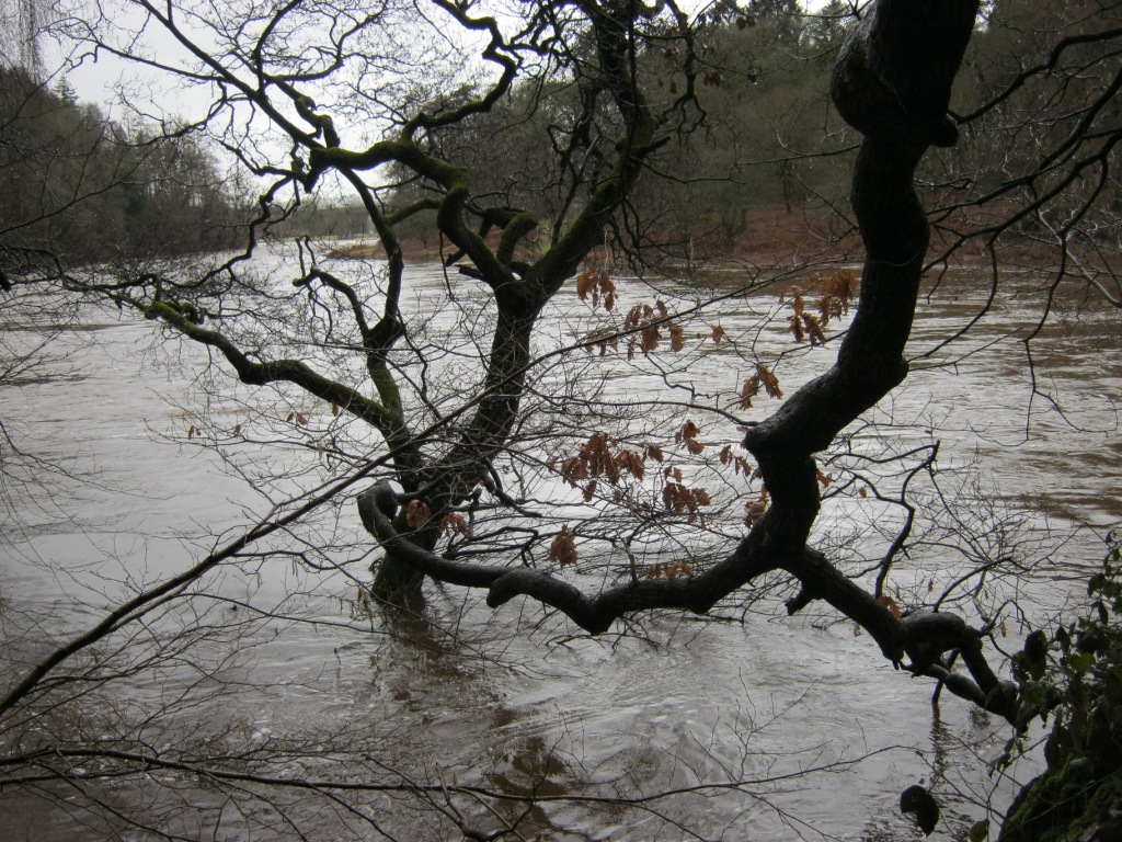
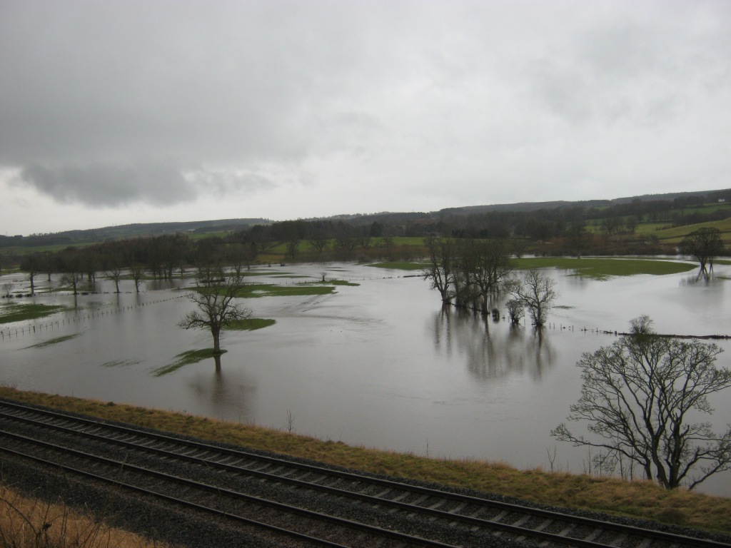
On reaching the road, I set off downhill for the path alongside the river as I wanted to see Lacey’s Caves – a set of caves carved out of a riverbank sandstone cliff over many years by a hermit called Lacey who lived there. The weather had been very wet indeed over the last few days though and the river, on approach, looked very full indeed! Would I get along the riverbank walk? A notice at the start of the path said not – it also said the path was closed. I didn’t suppose anyone was looking so set off to take the path…
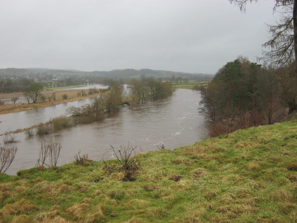
errr – the river’s grown a bit!

On descending to the river bank, the path was indeed missing for quite a long way in several places. I could have taken to the fields but there was a barbed-wire fence discouraging such actions. I persevered along the missing bank in the edge of the river for a way…

I happily waded through some bits until I got to the mud…


Suddenly, my boots started to sink into the thick mud and wouldn’t come out. As I managed to drag one foot out (nearly ripping the bottoms off my boots), the other would sink deeper. I floundered around for quite a while before I decided that several miles of this wasn’t really going to work – time to turn back. They were right after all – the footpath IS closed!
I headed back to the road and walked up to Glassonby village, noting on the map that there was also a ‘cairn circle’ on the way. I have to say this looked like another small stone circle to me…
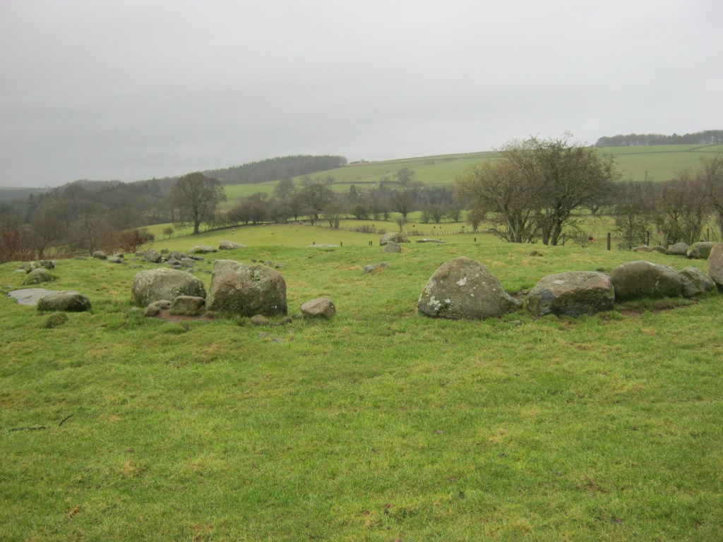
Cairn Circle, Glassonby village

The tree behind the circle, strangely, like a few other trees in the area, had a permanent ladder fixed to it!
There were some blasted and dead ash trees – I always find those fascinating so took photos. There were some great fungus on the second one…


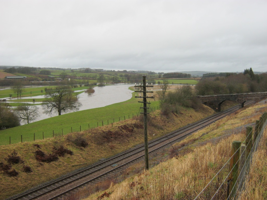
I took the long way round the roads back to the car noting that, as I turned off back to Long Meg, I was less than half a mile above Salkeld village. It was also too soon to head off back home so I studied the map back at the car and saw what looked like a footpath heading down to the river not long after the path through the farm next to the stone circle. I left the car again and set off to look for it – the footpath after the farm became muddier and muddier until I was literally wading in deep mud – ugh – thank goodness for the boots!
I reached a stream running downhill to join the river and continued on the main path for a way but could see the ‘path’ I’d seen on the map should have headed downhill in the woodland by the river. There definitely hadn’t been any path so I studied the map a lot harder. I decided that what I’d seen wasn’t really a footpath. However, I was determined to get to Lacey’s Caves and Salkeld Old Mine from this end so headed off down through the woodland. Near the bottom of the hill, there were various paths which headed down to the riverbank.
As soon as I joined the riverbank, I could see Lacey’s Caves not far away. I headed for them…

The path round to Lacey’s Caves complete with information plaque

Nice carved gateway
Very fast-flowing swollen river immediately below the path
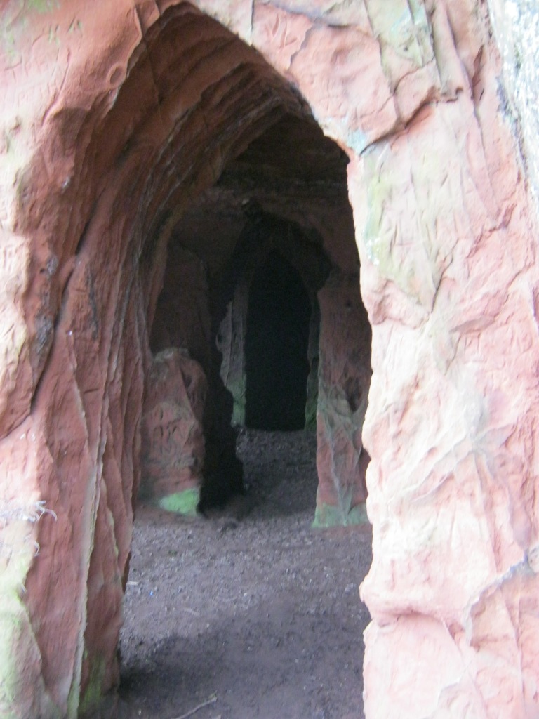
Lacey’s Caves entrance

River views


Very beautiful sandstone!
Looking out of the far ‘door’ of the caves, the path was eroded to a width of around eight inches and then it was straight down to the madly-flowing river – not a great plan. I turned back and returned through the caves to take the riverbank back towards the old mine…

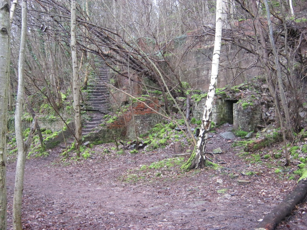
The old mine entrance was up a side shoot and was thoroughly blocked, although there is a little cave-in above the blocked entrance…

White boulders blocking mine entrance but a cave-in above

old chimney flue

Section of old mine railway

Looking back to Lacey’s Caves
yes, I was stood in the river!
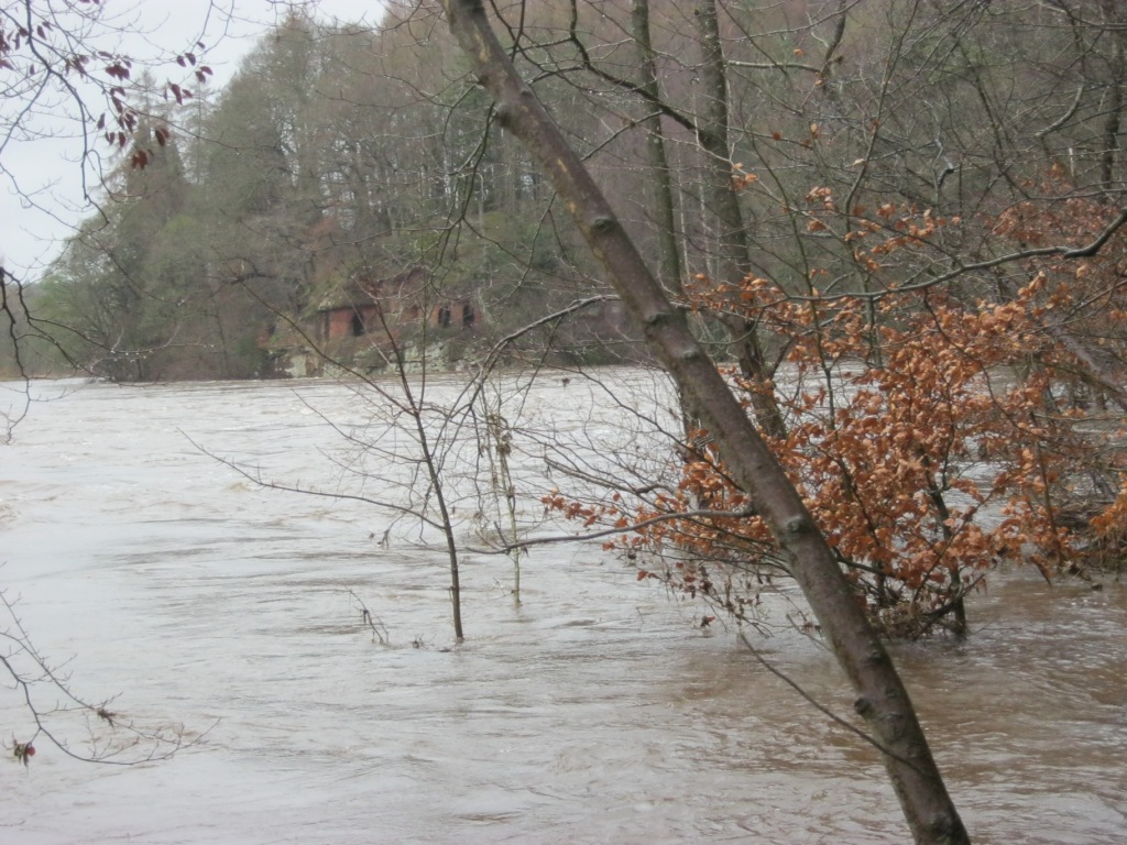
Every time I pass the caves on the nearby railway to visit my mother, I notice a house situated right by some rapids on the river – I always think it’s in quite a brave situation. It looked really brave today with the fierce floods!

rather them than me!

I then said goodbye to the old mine and set off for Salkeld village…
I soon exited the woods and joined a lane above the railway – I was treated to one of our trains going past to Skipton (my home town). I was absolutely delighted to see the old telegraph posts still in situ alongside the line here – these have been gone for at least 50 years now but I always used to love them!
I took some more photos of the floods… there was a van parked amongst them on a little island of grass (you might just see it on the photos – a little white one) – I wondered whether it would ever reach civilisation again! No idea where the driver was!

the little white van centre right looks pretty surrounded!

I then put the camera away as I’d reached the village and just had the half-mile back uphill to the stone circle. My legs and I were feeling quite tired by now – when I got back, I found I’d done just short of 10 miles – quite a way for me in winter (although not a great distance admittedly)… I’d also been away long enough on my walking (5 hours) to head off back. By the time I reached the house it would be after 1700 hours and any self-respecting workmen would have gone home by then!
You’re reading a post by Mountain Coward. If you’ve enjoyed this post, be sure to follow The Mountain Coward from my homepage

Well if you’ve got to get out of the house while some work has been done I can’t think of a better way to spend the time than a ten mile walk! And what a great and varied walk this was – beautiful landscape and trees, (I don’t think I’ve seen fungi like that before), rail and river and even a bit of history thrown in too. Little Meg looks a cute litte find, so not surprised you were impressed, and I love the look of Lacey’s Caves. It’s almost castle-like looking at the view into the entrance. Wonderful stuff.
Sorry I seemed to have missed this one. I’m completely immersed in my dissertation now, so although I hope to get one more post out before it’s due in I’m not really blogging all at the moment. Still, I caught up with my emails and saw your reblog from the Coven and it was nice to find this post too. Hope all’s well and that the work you had done went well – at least it gave you a great excuse to get out for a nice long and interesting ramble! 🙂
LikeLike
Actually, it was destructive work which was being done – I went out so I didn’t have to watch as it was going to make me very unhappy.
That was a great area for a walk though – very interesting and absorbing. Amazing how much of interest is in such a small area!
LikeLiked by 1 person
Oooh, sounds a nasty day’s work if it was that bad – don’t blame you wanting to be out of the way altogether. I’d do the same. Hope the walk helped take your mind off it. It certainly looks as though it did the trick.
LikeLike
Yes it did – I didn’t give home a thought until the gap between the 2 walks when I looked at my watch and decided it was too early to go back so went hunting for the caves and the mine.
LikeLiked by 1 person
Poor you. Must have been bad. Those caves must have helped though. I’d love to explore them. 🙂
LikeLiked by 1 person
A highly interesting shaunter. I’ll revisit this post when I’m next in the area. Thanks for posting.
LikeLike
It’s quite nice to walk from Lazonby & Kirkoswald railway station to Langwathby station – there are paths most of the way along the river. I walked with the Settle-Carlisle walkers once from Armathwaite to Langwathby – it was 18 miles and we missed Long Meg out but a lovely walk (albeit muddy in any season).
LikeLike
I love stone circles so this was useful though I’ve no idea where it is!
LikeLike
To the East of the M6 in the Eden Valley and the north of the A66. If you look on the map and find either the Settle-Carlisle railway or the River Eden, this is north of Appleby by about 10 miles and east of the river and railway.
LikeLike
Really enjoyed that Carol. That’s the same as me. I normally don’t enjoy walking in poor conditions if its simply miserable and boring but when its so spectacular and turns into an adventure I love it. Wild nature at its best and the caves look very good.
LikeLike
Those caves are excellent – and surprisingly warm!
I’d had a good look at the map of the area after I’d checked the weather forecast and saw there were a lot of things of interest there so it was a great place to go to spend a long time in bad weather.
LikeLike
Thank you for taking us along on this fabulous walk… So much to see… Stuck in my work-eat-sleep-work routine, I am most grateful! 🙂 Has the land recovered from the floods?
LikeLike
It probably had… but now we’re getting some more! and fierce gales (which I really hate!)
LikeLike
An intriguing corner of Cumbria.
LikeLike
There was a lot of interest and, apart from being wet and weary, I enjoyed my day!
LikeLiked by 1 person
Wonderful and fascinating post! Your pics show how wet it was. Your digital camera isn’t as wide as your film camera, still wonderful pics. I would like to see such circles and ruins. In this part of Canada if a structure dates back to the early 1900’s it is very old. I like your spirit to go as you please while being mindful and not intrusive.
LikeLike
I only saw one person all day!
LikeLike
That sounds like my kind of successful hike! 🙂
LikeLiked by 1 person